Developing Data Sharing Technologies and Relationships with Nile Basin Countries
Updates from the Center for Geospatial Solutions’ Transboundary Data Sharing Project
By: Olivia Snavely, Strategic Communications Associate, Center for Geospatial Solutions
Two years ago, the Center for Geospatial Solutions (CGS) joined the Early Warnings for All initiative, an international effort to expand lifesaving early warning systems with communities that bear the most impact from extreme weather and climate events. Publishing hydrometeorological data lies at the core of this work. In the Nile Basin’s complex, transboundary water systems, data management is both critical and complicated. 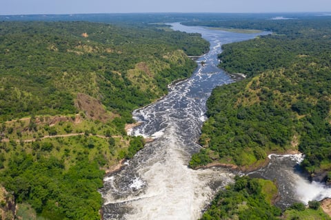
Building on the Internet of Water’s approach to interoperability, CGS began the Education, Training, and Capacity Development for Weather, Water, and Climate Forecasting (ETCD), a project of NOAA International Affairs Office of the National Weather Service, funded by the U.S. Government. The work focused on developing technical architecture for hydrometeorological data publication and building the partnerships needed to sustain data sharing. Nearly two years into the project, our team continues to develop the technical opportunities and adapt to the political realities that will shape the future of transboundary data sharing in Uganda, Ethiopia, and across the Nile Basin.
From the usefulness of semantic technology to the importance of sustained engagement with data users and providers, this first phase reinforced the value of the IoW’s core building blocks — open standards, data equity, and collaboration — and helped chart the path for what comes next.
Aerial view of Murchison Falls at Nile River, Uganda and the surrounding green forests.
Opportunities for Face-to-Face Collaboration
International work comes with an unavoidable hurdle: your collaborators work all over the world. So when CGS joined an in-person code sprint for the project at the National Research Council, we embraced the opportunity. Ben Webb, a Geoconnex developer, spent the week alongside international software developers and coders, immersed in 12-hour days dedicated to planning and building the technical tools needed to facilitate data sharing across national systems and languages.
Despite the intense timeline, Ben noted the significance of gathering in person. “The power of this work is that you’re taking experts from all around the world…an in-person event like this provides opportunity for both scheduled conversations and the conversations that naturally arise without the limits of virtual meetings.” The fluidity of face-to-face work kept the creative juices flowing, with dinner-time napkin doodles and structured work sessions alike contributing to solution brainstorming.
During one of these brainstorms, a collaborator from the United Nations suggested semantic technology as a possible way to build a transboundary data sharing system. Semantic technology asks data providers to describe their data with a shared terminology, rather than require them to change how they publish data to align identically with every other provider. This approach mirrors the IoW Coalition’s work in the United States, particularly CGS’s development of Geoconnex, which also relies on a semantic layer to enable findability.
The project also supported the technical development of and wider adoption of wis2box — the World Meteorological Organization’s (WMO) open source data publishing platform. More than 40 countries now publish through the software globally, and several partner institutions are preparing to deploy it in upcoming trainings. This growing adoption signals that open-source infrastructure is both viable and in demand, and it gives countries a practical path to share data while maintaining local control.
Connecting with Partners Domestically and Abroad
As wis2box expands access to meteorological data, the WMO also began collaborating with GEOGLoWS, a global hydrological forecasting system. While our project focuses on building systems to help Nile Basin countries publish existing data, GEOGLoWS’ focus on predictive hydrological information — a particularly valuable component in regions where monitoring networks vary — adds an important layer to the project by providing countries in the Nile Basin and beyond with critical water data, regardless of if and how they decide to share their existing data. Together, these tools can provide a more complete foundation for early warning systems.
“[The challenge] is not as much about sharing data or sharing water. It's about the decision-makers, their underlying interests, and the politics that play out because of those decisions, which either facilitate or hinder trust.” —Faith Sternlieb, Associate Director, Center for Geospatial Solutions
In preparation for such trainings, CGS Associate Director Faith Sternlieb recently traveled to Dakar, Senegal to participate in the High-level Preparatory Meeting for the 2026 United Nations Water Conference. As a member of the Women in Water Diplomacy Network (WWDN), she joined the WWDN-organized Dakar Water Diplomacy Symposium and Collective Engagement in the UN Water Conference Preparatory Meetings. These discussions examined water data diplomacy — a term Faith uses to acknowledge the complexities of water politics, facilitate open conversations about data challenges, and support broad collaboration towards solutions — from multiple but interrelated perspectives, with a strong emphasis on African water diplomacy practice and basin-level cooperation. Across themes of cooperation, water for people, investments in water, and more, participants highlighted data — its collection, management, sharing — as a key component of progress again and again.
.png?width=525&height=394&name=image%20(4).png) While attendees agreed on the need for improved data management and sharing systems, Faith noted how cooperation in data depends on relationships and trust. “[The challenge] is not as much about sharing data or sharing water,” Faith said. “It's about the decision-makers, their underlying interests, and the politics that play out because of those decisions, which either facilitate or hinder trust.”
While attendees agreed on the need for improved data management and sharing systems, Faith noted how cooperation in data depends on relationships and trust. “[The challenge] is not as much about sharing data or sharing water,” Faith said. “It's about the decision-makers, their underlying interests, and the politics that play out because of those decisions, which either facilitate or hinder trust.”
That familiar insight underscores the need for high-level water diplomacy and data providers, technologists, and users to have face-to-face opportunities to develop trust. As our project team looks ahead to site-specific training sessions, the connections built in Dakar, including with the Nile Basin Initiative, will prove invaluable. At their request, CGS will co-lead an in-person workshop in Uganda in April 2026 to build technical capacity in open source data platforms like wis2box, GEOGLoWS' river forecasting system, and more. The workshop will also facilitate engagement with data users and providers to discuss the benefits of data sharing for early warning systems and water management — and with new relationships Faith developed with Ethiopian hydro and meteorological services, such a workshop could expand the reach of our project.
Faith and other attendees at the Dakar Water Diplomacy Symposium. Left to right: Faith
Sternlieb, a WWDN member, Aluki Kotierk, Chair of the United Nations Permanent Forum on
Indigenous Issues, Marie-Amélie Pétré, Senior Scientist, Water Division, BRGM, France.
Looking Ahead: Where Do We Go Next?
As technical systems mature and relationships strengthen, the ETCD Africa project will provide nations with the technology and training they need to collect, maintain, and share critical data across the continent. By aligning open infrastructure with local expertise and water data diplomacy, this project will support efforts open source technologies for increased data publishing, connect hydrometeorological data to early warning systems, and facilitate sustainable water management across boundaries.
Comments on this post