Launching Open Data Access for Urban Climate Resilience in Africa
CGS Travels to Uganda Water and Environment Week
Olivia Snavely, Strategic Communications Associate, Center for Geospatial Solutions
May 2024
Hurricanes, droughts, floods — all are increasing in intensity, frequency, and duration. And yet, human casualties and economic damage have both decreased in no small part due to early warning systems (EWS). The alerts dispatched on weather apps, the Internet, and televisions are part of a system that mitigates massive damage from natural disasters. However, lagging use of these systems leaves populations in Africa, South Asia, South and Central America, and small island states at a disproportionate risk — up to 15 times the risk — during extreme weather- and water-related events.
In support of the Emergency Plan for Adaptation and Resilience (PREPARE), the Internet of Water joined the Early Warnings for All initiative, a multi-organization program developing these lifesaving systems with governments and communities that do not currently have them in place.
But what qualifies as “preparedness” or “early” is highly dependent: the type of precautions required and time needed to take those precautions changes based on the type of weather event and the location it’s occurring in. Community context defines effectiveness.
Supporting global water data access, staff from the Center for Geospatial Solutions (a co-leader of the IoW Coalition) along with the World Meteorological Organization (WMO), the National Oceanic and Atmospheric Administration (NOAA), and the University Center for Atmospheric Research (UCAR) started a new project: Open Data Access for Urban Climate Resilience in Africa. This multi-year project will support more complete climate, weather, and water data for use in EWS. Leveraging years of championing water data discovery in the United States, we’ll co-create data systems best suited to these locales.
Diving Into Uganda Water and Environment Week
To begin developing relationships with partners in Uganda, CGS team members Faith Sternlieb (Director, Global Engagement, IoW) and Ben Webb (Sr. Software Developer, IoW) attended Uganda Water and Environment Week (UWEWK). On the ground in Kampala, they immediately stepped into a diversity of early warning systems. In the midst of a heatwave and drought, the Uganda National Meteorological Authority (UNMA) was alerting people of the impending rainy season in several ways. From smartphones and radio broadcasts to UNMA personnel traveling out to communities to tell them directly, UNMA employed several methods of communication.

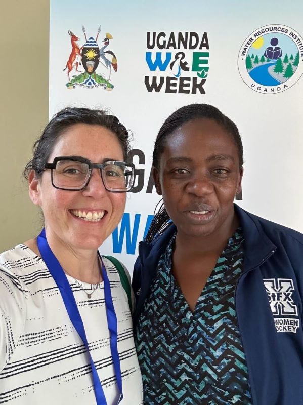
Nile Basin and North America Women in Water Diplomacy members (Prisca Nandede, Uganda Minsitry of Water and Environment and Faith Sternlieb, IoW) celebrating Uganda Water and Environment Week
But of course, UNMA’s ability to get and distribute this information rests on access to reliable data. At UWEWK, participants from organizations like the Nile Basin Initiative (NBI), WMO, and other groups working with Ugandans to improve their EWS, gathered to present and discuss initiatives.
Collaborating Across International Boundaries
Located in the Nile River Basin, 98% of Uganda’s water resources are transboundary, creating a hotbed for collaboration and engagement — key themes of UWEWK. CGS was among several groups that hosted side events, in collaboration with the Uganda Ministry of Water and Environment, UNMA, WMO, and the NBI to discuss international cooperation on data modernization. As Ben Webb noted, “The issues and the type of conversations that we’re having domestically with the IoW is nearly identical to the types of conversations we were having there…figuring out what is the best system and having a good faith partner is exactly what the IoW is doing domestically.” For any type of program or system to work, sustaining collaboration with partners on the ground is critical.
The issues and the type of conversations that we’re having domestically with the IoW is nearly identical to the types of conversations we were having there…figuring out what is the best system and having a good faith partner is exactly what the IoW is doing domestically.
Bringing Local Communities Into the Work
Domestically, we tend to think of community engagement in data as a matter of maintenance and accessibility, a responsibility falling primarily on data providers and the water data community. In Uganda, though, the concern falls more to data-collecting infrastructure. Regions lack the equipment to collect data or face vandalism of installed equipment, so community engagement concerns the local communities that physically interact with the landscape where data is collected. Creating buy-in amongst these communities is critical to the success of data collection and EWS implementation, and much of it comes down to engaging with these communities so they understand that the hardware is most valuable when it’s collecting data.
Creating Data Systems Tailored to Unique Environments
To get the best data, collection and engagement practices must be tied to the physical and social landscapes where the data resides. As work on this project continues, the IoW team will combine this philosophy with the appetite for collaboration by hosting targeted code sprints to develop wis2box, a free software for water and weather observations. These code sprints will be collaborative training sessions where technologists from across the open-source software world will gather in key African countries, including Uganda, to develop and tailor wis2box to fit the specific needs of each.
Convening these experts will create the opportunity to make substantial, targeted progress on the software while also tailoring it to the regions it will operate in. Listening sessions conducted in these regions will also seek to understand the unique data diplomacy that comes with the transboundary nature of places like the Nile River Basin. Combined, this work will help ensure that technologists have the resources to continue adapting the software as needs change on the ground.

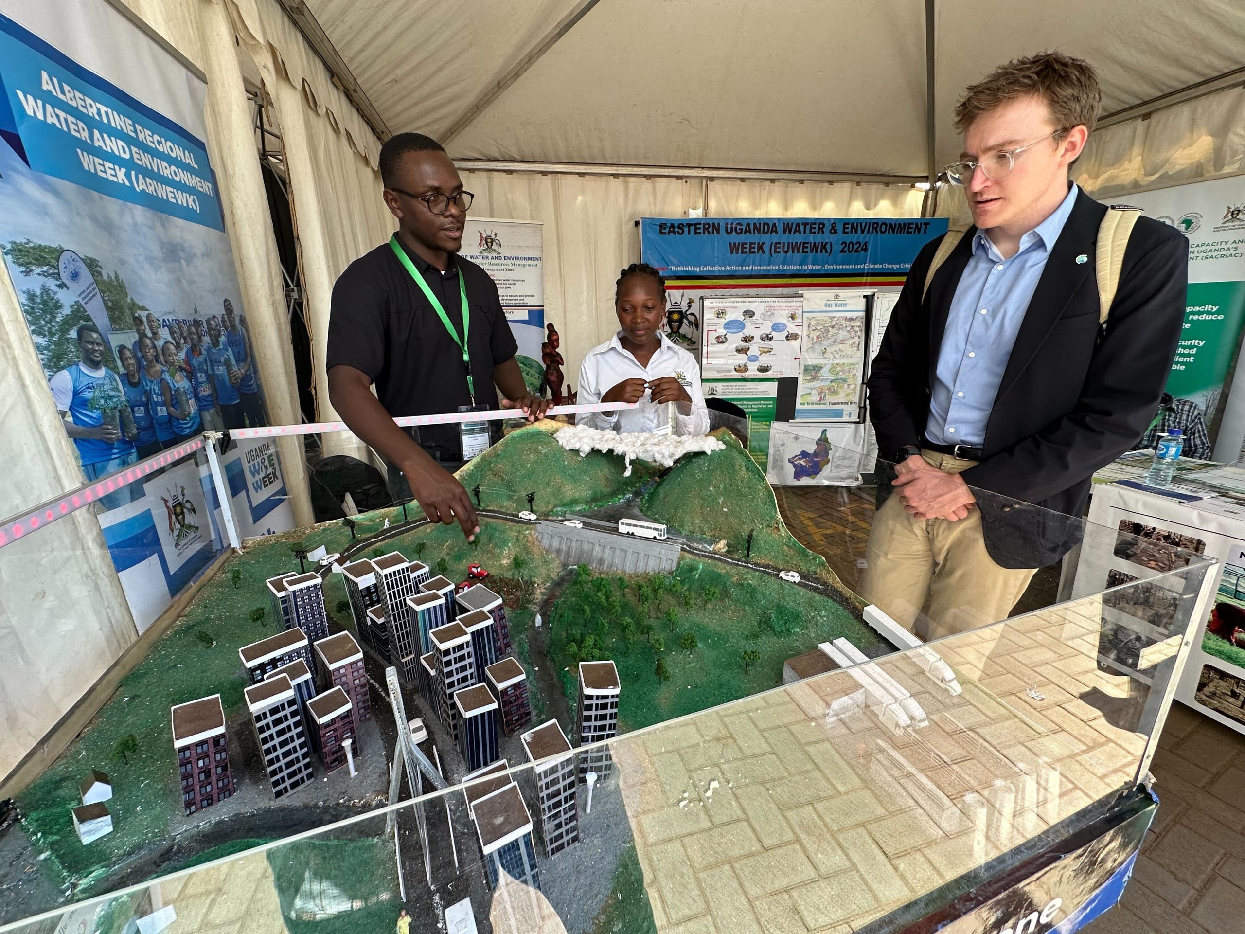
Andrew Awmz, Uganda Ministry of Water and Environment, explains a model of his region to Ben Webb, Software Developer II, IoW.
Building effective systems requires tailoring them to the communities they serve. With the acute need for local and international cooperation, Uganda exemplifies the critical challenges that countries across the Nile Basin are facing in EWS — and how IoW can serve and foster hydro-meteorologic data partnerships by developing software that reflect the reality of our shared water resources.
