The Geoconnex Advantage: Making Water Data Sharing Smarter and Simpler
Unlocking Water Data Potential Through Consistent Standards
Olivia Snavely, Strategic Communications Associate, Center for Geospatial Solutions
November 2024
When organizations consider sharing their water data publicly, one of the first questions that often arises is: “What’s in it for us?” It’s a fair one. With worries about the time or specialized knowledge required to adopt new data sharing standards, organizations need to understand the return on their investment in data sharing. As calls for water equity increasingly tie into the need for data equity, many organizations are faced with if and how they should make their data accessible.
Water Data Sharing: Public and Practical Benefits
Breaking down water data siloes has widespread public benefits. Hydrologists can access critical information to manage water resources more effectively, governments can make better policy decisions, and citizens can assess the safety of their drinking water . But there are also practical benefits for data-sharing organizations. When datasets from multiple sources are combined, the data itself becomes more useful. More context enables data to be fully understood, creating a clearer picture to inform decision-making.
By making this data accessible, organizations save time and resources in the long-term, since they’re able to find and use relevant data as needed.
The Internet of Water Coalition believes in the power of sharing data, so we’re building a first-of-its-kind engine to drive the water data-sharing movement forward for the benefit of everyone. Geoconnex is a new system that empowers water data sharing like never before. Built with internationally recognized standards and attention to accessibility, Geoconnex is designed to make it easier for organizations to share and find water data, allowing them to reap the benefits of data sharing, for their constituents and themselves.

To understand the current and potential impacts of our water systems, water data needs to be more accessible.
Water Data (Sharing) In Context
Data ownership is often fragmented among government agencies, tribal organizations, nonprofit institutions, and more. This fragmentation creates barriers to finding and accessing data, reducing its actual usefulness.
Some groups have tried to make their data portals a “one-stop-shop,” but without collaboration from other organizations, these portals will always be incomplete. The water data community needs a trusted system for data discovery and sharing. In the Geoconnex system, data producers retain control and responsibility of their data, ensuring accuracy. Organizations link their existing data to real-world locations, creating a fuller, contextual view when combined with other datasets. Each data point becomes more meaningful. Instead of accessing and seeing data solely by governance boundaries, users see a more complete picture of each water feature.
Geoconnex, built by and for the water data community, opens the door for data-sharing organizations to benefit alongside users by mitigating data division created by human-imposed boundaries.
Geoconnex…opens the door for data-sharing organizations to benefit alongside users by mitigating data division created by human-imposed boundaries.
Building a Better System for Public Water Data Sharing
Although there are existing data-sharing portals, they’re fundamentally limited by their construction. Not only do they lack the widespread collaboration needed from water organizations, but they’re also often built to unique data-sharing standards. The integrations and APIs act like temporary patches on a leaking boat — they might solve a problem temporarily, but before long, another patch will be needed. This results in organizations putting more resources into the platform, while users spend time learning updated APIs to publish or find the data.
Geoconnex changes this approach entirely, essentially building a brand-new boat. By adopting internationally agreed-upon standards, including Open Geospatial Consortium standards and W3C standards, the API used to publish and find data is accessible and familiar to the entire community. Consistently applying these standards means that past work becomes the foundation for data sharing. Geoconnex’s workflow allows data publishers to easily adopt these standards, while the software infrastructure uses them to make data navigable and accessible.
This makes Geoconnex a data-sharing system adaptable to new situations and users without the need for additional patches or APIs, saving users on both ends time and resources.
Guiding Organizations Toward Data Maturity for Better Water Management
After developing the Geoconnex backend and securing a cooperative agreement with the United States Geological Survey to continue scaling the technology, the IoW Coalition is focused on building critical mass of users — both data publishers and seekers — to enrich the water data landscape.
Our efforts are aimed at making Geoconnex a data commons accessible to all. On the publishing side, we’re creating a user interface that enables organizations to index their data portals to Geoconnex without GitHub expertise. Reducing technical barriers to data sharing reduces the resources organizations need to dedicate to the process, opening the door for smaller organizations to participate as well.

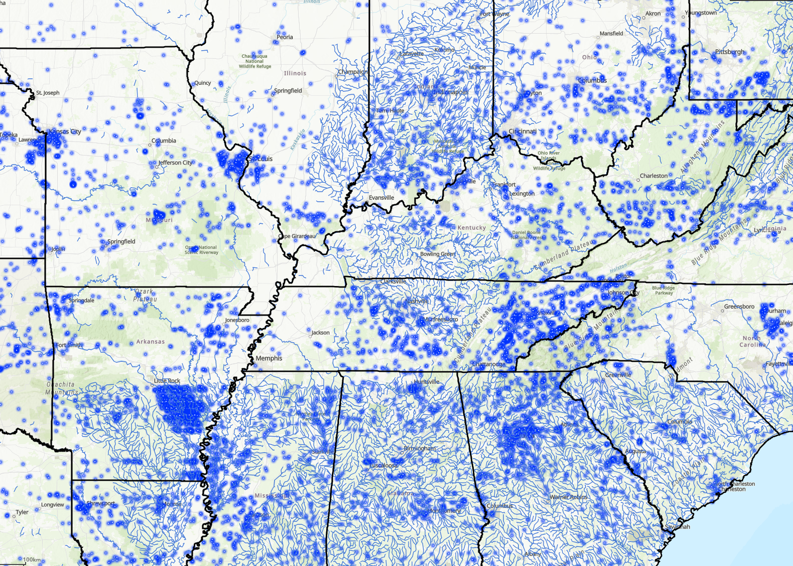
A view of the Geoconnex Dashboard (linked) detailing streams and gages from the USGS and California Data Exchange Center
With feedback from IoW Coalition members , the team developing Geoconnex has been able to add even more value. For example, future versions of Geoconnex will prioritize accessibility of non-industry users, developing applications that help people find information about drinking water safety and other public concerns.
Ultimately, Geoconnex will empower by addressing core technical issues with consistent data standards. This approach helps data publishers become more independent, no longer reliant on specific teams or consultants to maintain and learn new patches or APIs. Instead, they can use tools they already know t o share data in a way that anyone can access and understand.
With Geoconnex, sharing data benefits everyone—from decision-makers to the public and other data organizations—making it a smart, easy new approach for any organization committed to data transparency and impact.
Photo Credits
Header Photo: velion x, Unsplash
