Inventories

The Internet of Water Coalition seeks to accelerate efforts to make public data more discoverable, accessible, and usable. One starting point is to understand what publicly collected water data already exists.

This requires an inventory.


Access Data Inventory Tool

What are FAIR data standards?

FAIR represents data that are Findable, Accessible, Interoperable, and Reusable. The Internet of Water’s Inventory Tool helps public data providers understand how to make their data FAIR.

Inventory of Federal and State Water Data

This white paper on building a data inventory describes the rationale and methods behind the data inventory. Additionally, it provides a detailed description of the openness score and its components.

Inventory Tool

The Nicholas Insitute Water Policy Program inventoried federal and state governments to understand what water data are currently collected and how those data are discovered, accessed, and made usable.

The Structure of Data Sharing within each Inventory

Inventories_Entities_Platforms_Circles
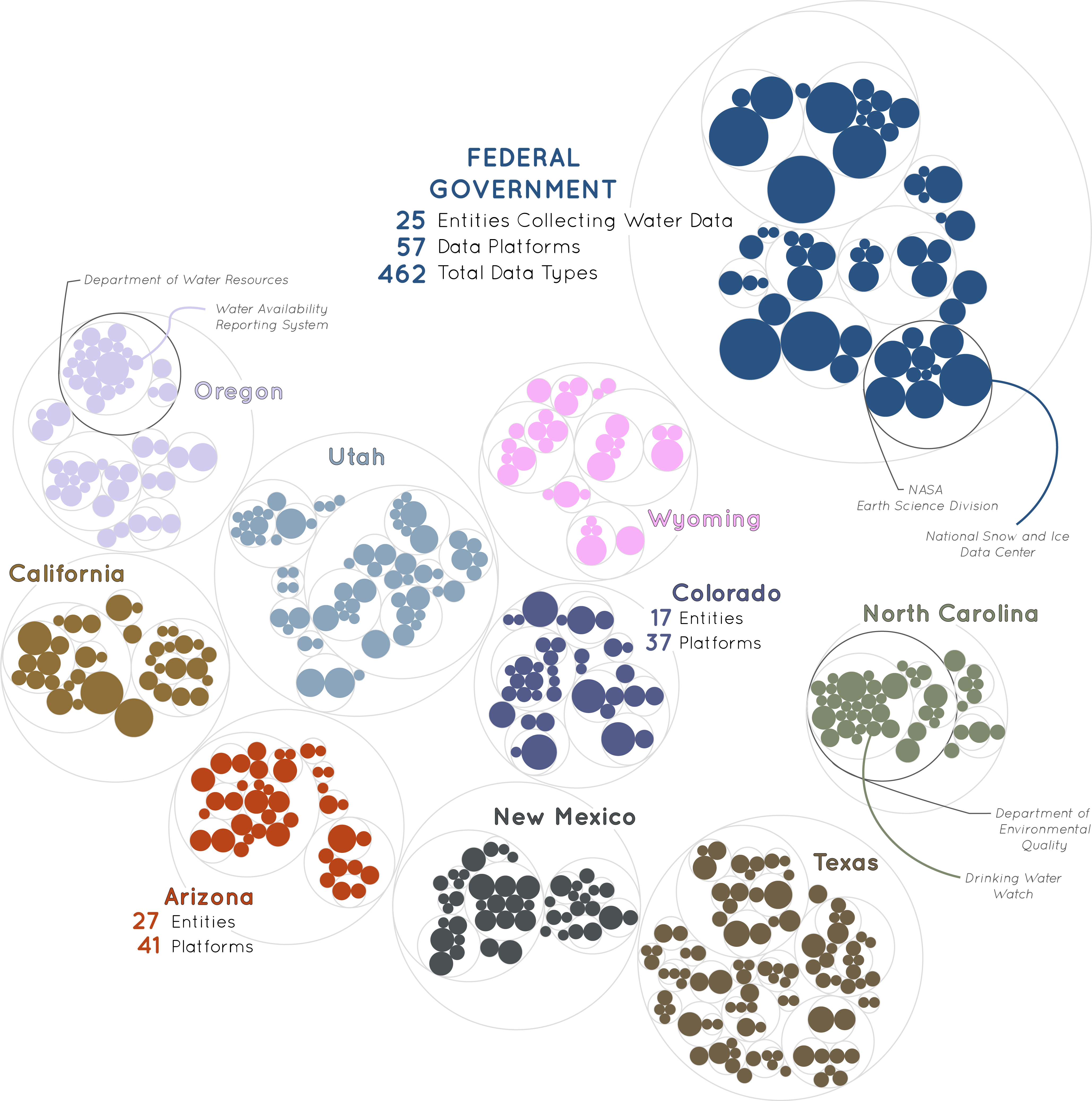
Understanding Data Fragmentation

Every individual platform (represented by solid circles) is shown sized relative to the number of data types it provides. Each platform is grouped within its data-collecting entity (represented by hollow circles) – the department or agency that collects and shares water data. For example, NASA uses remote sensing to estimate changes in groundwater, algal blooms, flood extents, evapotranspiration, and so on, specifically providing data on snow and ice cover via the National Snow and Ice Data Center.

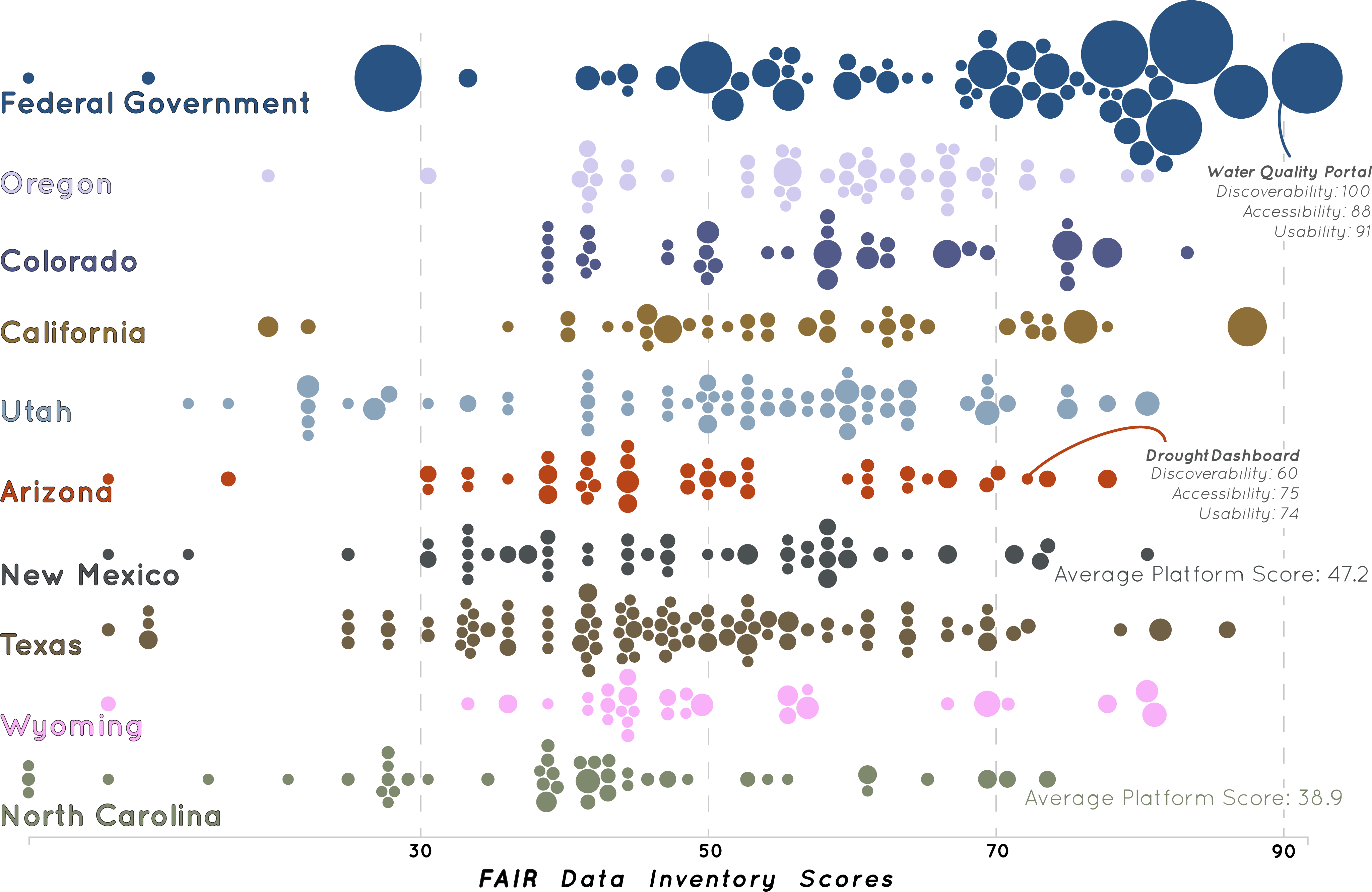
FAIR Ratings for Each Platform

FAIRness metrics were designed to enable comparison of data openness within and across inventories. Each platform was ranked according to an ousider’s perspective and do not take into consideration that these platforms were rarely designed to be FAIR. Often, platforms are designed to meet the needs of a specific community and may be meeting those needs well.

Inventories_Platform_Scores_Beeswarm

Build Your Own Inventory

Learn about the public agency inventory process. For the general public, outsiders want to know: Who is collecting water data and for what purpose? What types of water data are collected? And how discoverable, accessible, and usable are those data for secondary users?

We have developed a template and provided metadata so that federal and state pubic agencies may create their own inventory and, if desired, share that inventory with us online. This template provides descriptions of the tabs, column names, and dropdown menu selections.

We have also developed a template for inventorying water data held by other state agencies. A brief description of tabs is provided. Please see the metadata template for column descriptions.

This template allows users to create spreadsheets, combine worksheets into a single file for the website, create a heatmap, the combined scorecard for all hub inventories, and create basic graphics similar to what is seen in the inventory tool (accessed above).