by Lillian Watson | Feb 2, 2022 | Events, Webinars
Why is stakeholder engagement important? Is all stakeholder engagement the same? Should we engage differently with stakeholders around technology projects? Ashley Ward, Engagement and Outreach Associate for the Internet of Water Project at Duke University, has been engaging with stakeholders throughout the nation on a diversity of topics for over a decade. In this webinar, Ashley Ward will discuss the Internet of Water’s four-step process for stakeholder engagement and share lessons learned from working with stakeholders on technology and data projects.

by Lillian Watson | Jan 20, 2022 | Blog
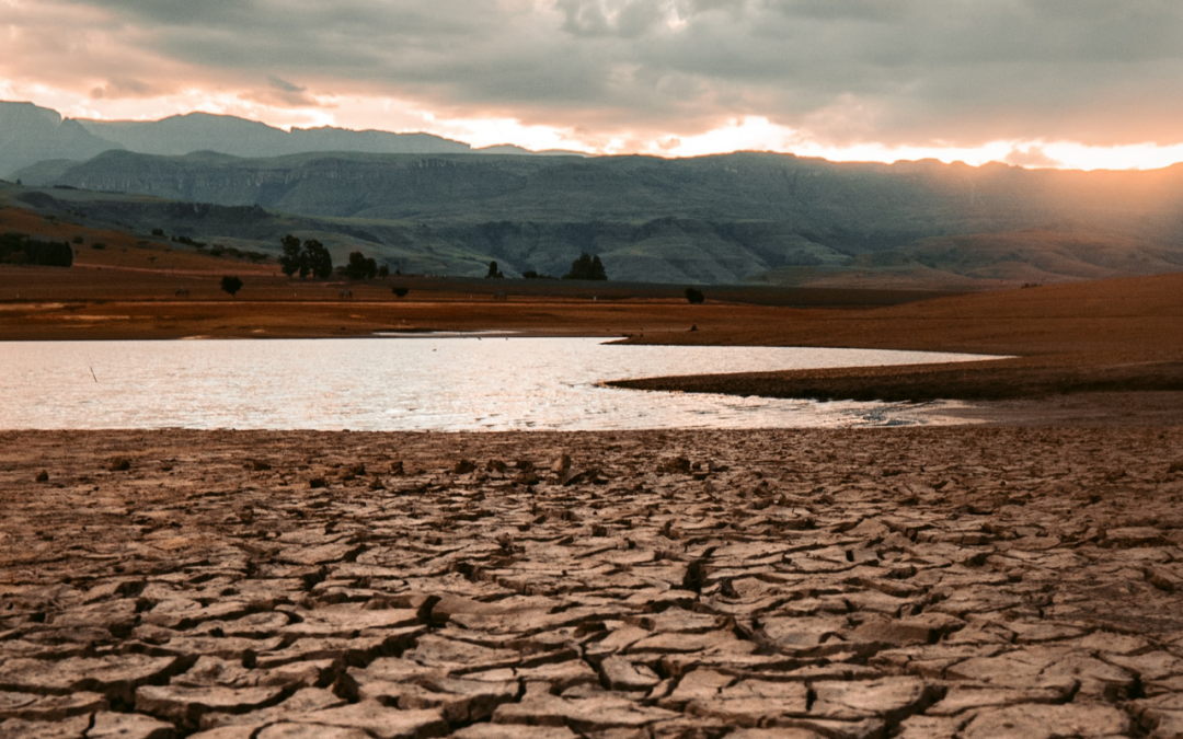
Early December 2021 was the first time in 13 years that at least half of the state of North Carolina was in Severe Drought or worse. A lot has changed in the world of drought monitoring since our last widespread severe drought, especially the data we use and how we visualize and share it. This current drought has made the power of those advancements clear.
by Lillian Watson | Jan 6, 2022 | Events, Webinars
Modern utilities are constantly evaluating new technologies and processes to streamline workflows and increase sustainability. In this webinar, you’ll hear how innovative data management at one of the country’s largest water and wastewater utilities is improving decision-making and supporting strategic priorities. Featuring Yvonne Carney, Strategic Performance Director, WSSC Water, Office of Strategy and Innovation.

by Lillian Watson | Jan 5, 2022 | Blog, Data Stories, Improved Decision-Making, Time Savings
PFAS (per- and poly-fluoroalkyl substances) are a group of synthetic chemical compounds and emerging contaminants that have been found in water all over the country. North Carolina has had well-publicized concerns with PFAS contamination, which have led to various data collection efforts across multiple organizations. These disparate datasets will be used to guide future regulation and enforcement across the state. But, without greater coordination between the academic and policy communities in North Carolina, these data will remain fragmented, limiting their ability to provide timely and accurate insights about PFAS contamination.

by Lillian Watson | Dec 14, 2021 | Blog
Everyone needs water, but many Americans are struggling to pay the rising costs of water services. The Nicholas Institute for Environmental Policy Solutions’ Water Policy Program has developed a water affordability dashboard that allows users to assess affordability across different water utilities using flexible, self-selected parameters.

by Lillian Watson | Nov 18, 2021 | Blog
Without consistent, standardized, and easily accessible water data, the true state of water resources is not accurately represented. As a result, data users may make faulty assumptions and ill-informed decisions. Poor decisions can be catastrophic, especially as water resources become both increasingly scarce and in high demand. IoW is developing a solution.
by Lillian Watson | Oct 21, 2021 | Blog
Nearly 70 years after Steinbeck wrote East of Eden, his words still ring true. With satellite images showing receding reservoirs contoured with pale bathtub rings of dry earth, drab mountain peaks where white snowpack melted away months ago, and so much smoke, the dry years have again put a terror across California.
by Lillian Watson | Oct 19, 2021 | Events, Webinars
Montana has a robust network of USGS stream gages funded by many different local groups and managed for many different needs. Hear from the Montana Department of Natural Resources and Conservation about an innovative Story Map they created to promote public awareness of the role stream gages play in managing Montana’s water resources.

by Ashley Ward | Sep 24, 2021 | Blog
What exactly is a water data hub? What should it be? With no roadmap or guidebook to follow, how do you design a hub? What sort of catalyst is needed to really get the ball rolling and build momentum? In Texas, the answer to the last question is steady effort over a number of years followed by a massive hurricane.

by Ashley Ward | Sep 24, 2021 | Blog, Data Stories, Improved Decision-Making, Innovation, Time Savings
As we work to create an internet of water – a world with more accessible, discoverable, and interoperable water data – we like to highlight the organizations who are contributing to this vision and explore the benefits they provide to water management and other sectors. The Groundwater Protection Council has been improving groundwater and energy data since 1983 and leverages that data to enable environmental protection and increased water availability. The resources they provide to state oil and gas agencies are essential to coordinating regional approaches in the energy-water nexus.
by Ashley Ward | Sep 2, 2021 | Blog
Freshwater harmful algal bloom (FHAB) season is here. In lakes, ponds, rivers, and streams across the country tiny microorganisms are reproducing in mass. Spurred on by the heat and high concentrations of nutrients, blue-green algae form a thick green scum on the surface of water bodies. This scum is not only foul-smelling, it’s also dangerous.
by Ashley Ward | Aug 26, 2021 | Events, Webinars
Over the past two years, the Internet of Water and The Commons have been collaborating with Native American tribal governments, leading community science NGOs, California’s Water Control Boards, members of the California Office of Environmental Health Hazard and Assessment, and the Water Data Collaborative to enable state agencies to leverage monitoring data to better inform the public about local freshwater algal blooms. Hear from a panel of project leaders about implementing all aspects of the project – tiered data management, database alignment, API development, software training, stakeholder engagement, and more.
by Ashley Ward | Aug 26, 2021 | Events, Webinars
The Commons is partnering with the Shenandoah Riverkeeper to help enact the Shenandoah Watershed Compact, a shared vision for a clean, healthy river. Learn about how they are developing a watershed map with real-time monitoring data to support water quality advocacy with state environmental agencies.
by Ashley Ward | Jul 22, 2021 | Blog
In this blog, we discuss the importance of and need for cities to modernize water data. Using stakeholder engagement to incorporate local knowledge, the partners in this project in Boerne, TX, gained important perspectives, ideas, and approaches to inform the creation of the Internet of Water’s first municipal water data hub.
by Ashley Ward | Jul 7, 2021 | Events, Webinars
This webinar introduces SensorThings API, an open standard for data providers to publish interoperable data, and data users to build workflows and applications built on standard interfaces applicable across all implementing data providers. You will learn about how to use the API to get data, including from several example data providers. You will also learn how to set up your own.

by Ashley Ward | Jun 28, 2021 | Blog
Water data have an enormous potential to enhance sustainability, improve management, and inform decision-making when they are freely available and easily accessible. “Open data”, as it’s called, is especially useful when it is consolidated in a single, open platform or data hub from which data can easily be searched, downloaded, republished, and otherwise utilized as needed.